Файл:Map of Paracel Islands.png

Учурда көрсөтүлүүчү өлчөм: 776 × 599 пиксел Башка уруксаттар: 311 × 240 пиксел | 622 × 480 пиксел | 994 × 768 пиксел | 1 138 × 879 пиксел.
Түп нуска файл (1 138 × 879 пиксель, файлдын өлчөмү: 52 KB, MIME түрү: image/png)
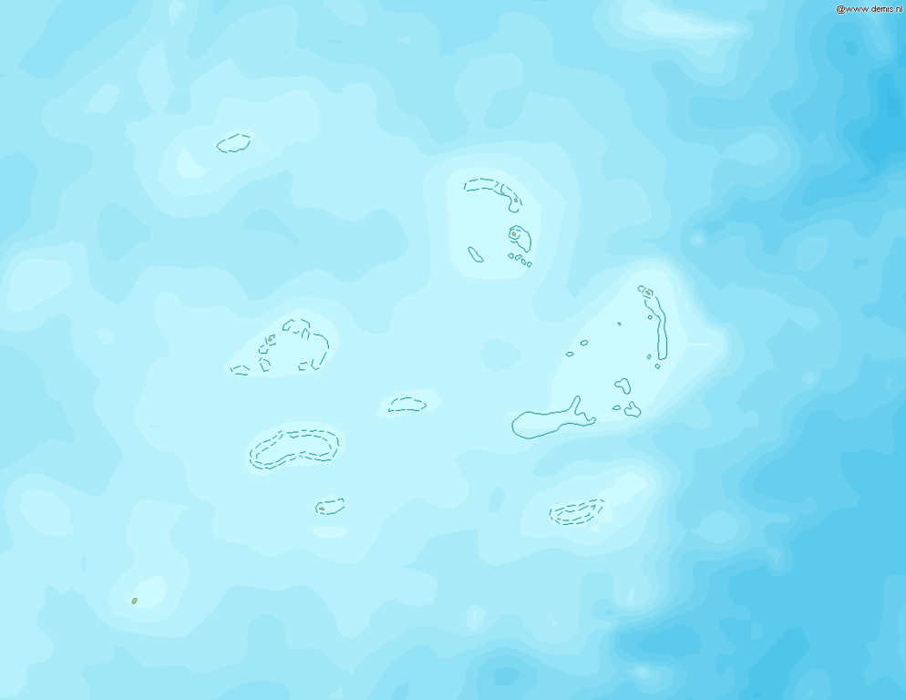
Map of Paracel Islands
Bounding box West 110.8°, South 15.5°, East 113.5°, North 17.5°. Center at 16°30′00″N 112°09′00″E / 16.50000°N 112.15000°E.
This image is in the public domain because it came from the site https://www.demis.nl/products/web-map-server/examples/ and was released by the copyright holder. Permission is granted to copy, distribute and/or modify this map since it is based on free of copyright images from: www.demis.nl. See also approval email on de.wp and its clarification.
|
| This work has been released into the public domain by its copyright holder, www.demis.nl. This applies worldwide. In some countries this may not be legally possible; if so: www.demis.nl grants anyone the right to use this work for any purpose, without any conditions, unless such conditions are required by law.
|
Файлдын тарыхы
Файлдын мурдагы нускасын көрүү үчүн тийиштүү убакыт/датаны басыңыз
| Убакыт/дата | Миниатюра | Өлчөм | Колдонуучу | Түшүндүрмө | |
|---|---|---|---|---|---|
| учурдагы | 19:06, 20 декабрь 2006 | | 1 138 × 879 (52 KB) | Mats Halldin~commonswiki | Map of Paracel Islands Bounding box West 110.8°, South 15.5°, East 113.5°, North 17.5°. Center at {{coor d|16.50000|N|112.15000|E|scale:1200000}}. {{demis-pd}} category:maps of Paracel Islands |
Шилтемелер
Бул файл төмөнкү баракта колдонулат:
Файлдын глобалдык колдонулушу
Бул файл төмөнкү викилерде колдонулат:
- fr.wikipedia.org сайтындагы колдонулушу