Файл:Africa-countries-central.png
Чоңураак нускасы жок.
Africa-countries-central.png (360 × 392 пиксель, файлдын көлөмү: 10 KB, MIME түрү: image/png)

|
File:Africa-countries-central.svg is a vector version of this file. It should be used in place of this PNG file when not inferior.
File:Africa-countries-central.png → File:Africa-countries-central.svg
For more information, see Help:SVG. |
 |
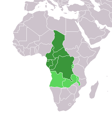
Map of countries in Central Africa.
This map was made by w:User:Joy and originally uploaded to the English Wikipedia as Africa-central-countries.png at 01:32, 28 March 2004. It is a modification of Image:BlankMap-World.png.

|
Permission is granted to copy, distribute and/or modify this document under the terms of the GNU Free Documentation License, Version 1.2 or any later version published by the Free Software Foundation; with no Invariant Sections, no Front-Cover Texts, and no Back-Cover Texts. A copy of the license is included in the section entitled GNU Free Documentation License. |
| This file is licensed under the Creative Commons Attribution-Share Alike 3.0 Unported license. | ||
| ||
| This licensing tag was added to this file as part of the GFDL licensing update. |
Файлдын тарыхы
Файлдын белгилүү бир учурдагы көрүнүшүн көрүү үчүн тийиштүү убакыт/датаны басыңыз
| Убакыт/дата | Миниатюра | Өлчөм | Колдонуучу | Түшүндүрмө | |
|---|---|---|---|---|---|
| учурдагы | 18:21, 17 март 2018 | | 360 × 392 (10 KB) | Maphobbyist | Montenegro border |
| 18:06, 13 январь 2014 |  | 360 × 392 (10 KB) | VVVF | Some corrections | |
| 19:52, 9 июль 2011 |  | 360 × 392 (13 KB) | Maphobbyist | South Sudan has become independent on July 9, 2011. Sudan and South Sudan are shown with the new international border between them. | |
| 11:10, 5 май 2006 |  | 360 × 392 (4 KB) | Hautala | optimized with png | |
| 18:30, 29 апрель 2005 |  | 360 × 392 (14 KB) | ChongDae | from en:Image:Africa-countries-central.png {{GFDL}} Category:Maps of Africa |
Шилтемелер
Бул файл төмөнкү баракта колдонулат:
Файлдын глобалдык колдонулушу
Бул файл төмөнкү викилерде колдонулат:
- fr.wikipedia.org сайтындагы колдонулушу
- he.wikipedia.org сайтындагы колдонулушу
- ht.wikipedia.org сайтындагы колдонулушу
- incubator.wikimedia.org сайтындагы колдонулушу
- is.wikipedia.org сайтындагы колдонулушу
- is.wiktionary.org сайтындагы колдонулушу
- kaa.wikipedia.org сайтындагы колдонулушу
- kbd.wikipedia.org сайтындагы колдонулушу
- ko.wikipedia.org сайтындагы колдонулушу
- mg.wikipedia.org сайтындагы колдонулушу
- nl.wikipedia.org сайтындагы колдонулушу
- nn.wikipedia.org сайтындагы колдонулушу
- oc.wikipedia.org сайтындагы колдонулушу
- pl.wikipedia.org сайтындагы колдонулушу
- ru.wikipedia.org сайтындагы колдонулушу
- sl.wikipedia.org сайтындагы колдонулушу
- sv.wikipedia.org сайтындагы колдонулушу
- sv.wikinews.org сайтындагы колдонулушу
- szl.wikipedia.org сайтындагы колдонулушу
- tk.wikipedia.org сайтындагы колдонулушу
- tt.wikipedia.org сайтындагы колдонулушу
- uk.wikipedia.org сайтындагы колдонулушу
- uz.wikipedia.org сайтындагы колдонулушу
- wo.wikipedia.org сайтындагы колдонулушу
- yi.wikipedia.org сайтындагы колдонулушу