Файл:Asia laea relief location map.jpg

Учурда көрсөтүлүүчү өлчөм: 674 × 599 пиксел Башка уруксаттар: 270 × 240 пиксел | 540 × 480 пиксел | 864 × 768 пиксел | 1 181 × 1 050 пиксел.
Түп нуска файл (1 181 × 1 050 пиксель, файлдын өлчөмү: 1,23 MB, MIME түрү: image/jpeg)
Жыйынтыгы
| Сыпаттама |
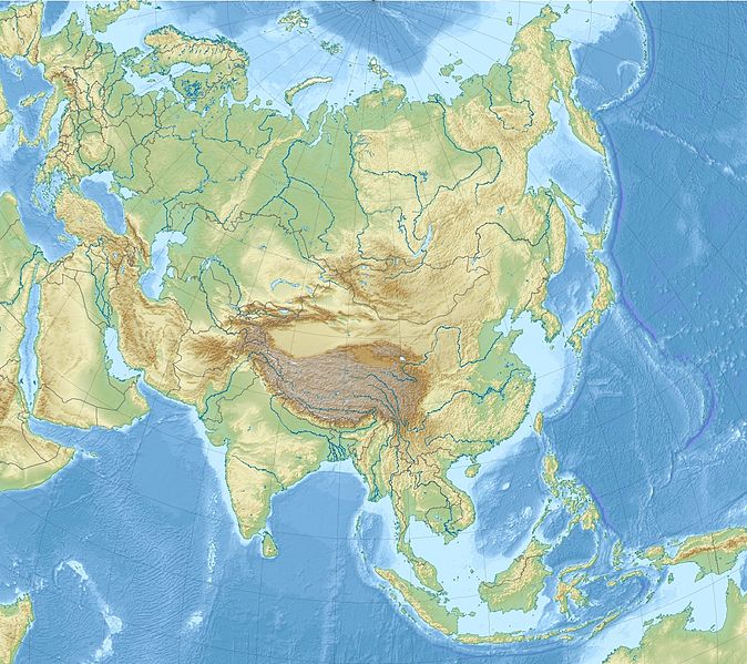
English: Relief Location map of Asia.
|
| Дата | |
| Булак | Өздүк чыгарма |
| Автор | Uwe Dedering |
Лицензиялоо
I, the copyright holder of this work, hereby publish it under the following licenses:
This file is licensed under the Creative Commons Attribution-Share Alike 3.0 Unported license.
- Сиз буларга эркинсиз:
- бөлүшүү – чыгарманы көчүрүү, жайылтуу жана өткөрүп берүү
- ремикс кылуу – чыгарманы ылайыкташтыруу
- Төмөнкү шарттарда:
- атрибуция – Сиз тийиштүү насыя берип, лицензияга шилтеме калтырып жана өзгөртүүлөр болсо көрсөтүшүңүз керек. Сиз муну кандайдыр бир акылга сыярлык жол менен жасай аласыз, бирок лицензиар сизди же сиздин колдонууңузду жактырган кандайдыр бир жол менен эмес.
- Бирдей шарттар боюнча бөлүшүү – If you remix, transform, or build upon the material, you must distribute your contributions under the same or compatible license as the original.

|
Permission is granted to copy, distribute and/or modify this document under the terms of the GNU Free Documentation License, Version 1.2 or any later version published by the Free Software Foundation; with no Invariant Sections, no Front-Cover Texts, and no Back-Cover Texts. A copy of the license is included in the section entitled GNU Free Documentation License. |
Каалаган лицензияны тандай аласыз.
Файлдын тарыхы
Файлдын мурдагы нускасын көрүү үчүн тийиштүү убакыт/датаны басыңыз
| Убакыт/дата | Миниатюра | Өлчөм | Колдонуучу | Түшүндүрмө | |
|---|---|---|---|---|---|
| учурдагы | 14:33, 26 ноябрь 2010 | | 1 181 × 1 050 (1,23 MB) | Uwe Dedering | {{Information |Description={{en|1= Relief Location map of Asia. * Projection: Lambert azimuthal equal-area projection. * Area of interest: :* N: 90.0° N :* S: -10.0° N :* W: 45.0° E :* E: 145.0° E * Projection center: :* NS: 40.0° N :* WE: 95.0° E * |
Шилтемелер
Бул файлды колдонгон барактар жок.
Файлдын глобалдык колдонулушу
Бул файл төмөнкү викилерде колдонулат:
- ar.wikipedia.org сайтындагы колдонулушу
- arz.wikipedia.org сайтындагы колдонулушу
- ast.wikipedia.org сайтындагы колдонулушу
- av.wikipedia.org сайтындагы колдонулушу
- azb.wikipedia.org сайтындагы колдонулушу
- az.wikipedia.org сайтындагы колдонулушу
- ban.wikipedia.org сайтындагы колдонулушу
- ba.wikipedia.org сайтындагы колдонулушу
Бул файлдын глобалдык колдонулушун көрүү.