Түп нуска файл(SVG файл, шарттуу түрдө 512 × 596 пиксел, файлдын өлчөмү: 132 KB)

Бул файл Викиказына долбоорунан. Ошондой эле башка долбоорлордо пайдаланылышы мүмкүн. Төмөндө файлды сыпаттоо барагындагы сыпаттамасы көрсөтүлгөн.

Жыйынтыгы

Сыпаттама
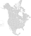
English: Map of North America and its second-level political divisions. Canadian provinces, US and Mexican states. Canada, Mexico, United States.

Non-contiguous parts of a states/provinces are "grouped" together with the main area of the state/provinces, so any state/provinces can be coloured in completion with one click anywhere on the state/provinces's area.

Also, all states/provinces have a "id" attached to them, making them easy to find. Select "find" and then enter in the state/provinces's ISO 3166-2 code in the "id" field to find it. The codes can be found here (Canada), here (USA) and here (Mexico).
Дата
Булак

Canada and US map: BlankMap-USA-states-Canada-provinces, HI closer.svg by Lokal_Profil.
Mexico map: Mexico template.svg by Mario Fuente Cid
Combined by Alex Covarrubias.

 
The SVG code is valid.
 
This vector image was created with Inkscape, and then manually edited
.
 
W3C-validity not checked.
Автор Alex Covarrubias
Уруксат
(Бул файл кайрадан колдонууда)
w:en:Creative Commons
атрибуция Бирдей шарттар боюнча бөлүшүү
This file is licensed under the Creative Commons Attribution-Share Alike 2.5 Generic license.
Сиз буларга эркинсиз:
  • бөлүшүү – чыгарманы көчүрүү, жайылтуу жана өткөрүп берүү
  • ремикс кылуу – чыгарманы ылайыкташтыруу
Төмөнкү шарттарда:
  • атрибуция – Сиз тийиштүү насыя берип, лицензияга шилтеме калтырып жана өзгөртүүлөр болсо көрсөтүшүңүз керек. Сиз муну кандайдыр бир акылга сыярлык жол менен жасай аласыз, бирок лицензиар сизди же сиздин колдонууңузду жактырган кандайдыр бир жол менен эмес.
  • Бирдей шарттар боюнча бөлүшүү – If you remix, transform, or build upon the material, you must distribute your contributions under the same or compatible license as the original.
Башка нускалар

Derivative works of this file:

Captions

Add a one-line explanation of what this file represents

Items portrayed in this file

depicts англисче

copyright status англисче

copyrighted англисче

7 октябрь 2007

Файлдын тарыхы

Файлдын мурдагы нускасын көрүү үчүн тийиштүү убакыт/датаны басыңыз

Убакыт/датаМиниатюраӨлчөмКолдонуучуТүшүндүрмө
учурдагы01:51, 23 ноябрь 202001:51, 23 ноябрь 2020 -дагы версиясы үчүн кичирейтилген сүрөтү512 × 596 (132 KB)Ponderosapine210Added the prominent islands of Manitoulin (Ontario) and Isle Royale (Michigan) to the Great Lakes.
23:07, 1 июнь 201923:07, 1 июнь 2019 -дагы версиясы үчүн кичирейтилген сүрөтү512 × 596 (130 KB)Fluffy89502added territories, made DC visible, adjusted mexican borders
12:23, 4 апрель 201412:23, 4 апрель 2014 -дагы версиясы үчүн кичирейтилген сүрөтү1 712 × 1 992 (270 KB)Lommesmade the borders between the mexican subdivisions the same size as their canadian / us counterparts.
23:23, 8 декабрь 200723:23, 8 декабрь 2007 -дагы версиясы үчүн кичирейтилген сүрөтү1 712 × 1 992 (327 KB)Lokal ProfilCode cleanup
07:55, 7 октябрь 200707:55, 7 октябрь 2007 -дагы версиясы үчүн кичирейтилген сүрөтү1 712 × 1 992 (342 KB)AlexCovarrubias== Summary == {{Information |Description=Map of North America and its second-level political divisions. Canadian provinces, US and Mexican states. Canada, Mexico, United States. |Source=Canada and US map by Alan Rockefeller. Mexico map by Alex Covarrubias

Бул файлды колдонгон барактар ​​жок.

Файлдын глобалдык колдонулушу

Бул файл төмөнкү викилерде колдонулат:

Метамаалымат