Файл:United Kingdom relief location map.jpg

Учурда көрсөтүлүүчү өлчөм: 388 × 600 пиксел Башка уруксаттар: 155 × 240 пиксел | 310 × 480 пиксел | 497 × 768 пиксел | 662 × 1 024 пиксел | 1 348 × 2 083 пиксел.
Түп нуска файл (1 348 × 2 083 пиксель, файлдын өлчөмү: 831 KB, MIME түрү: image/jpeg)
Du
Жыйынтыгы
| Сыпаттама |
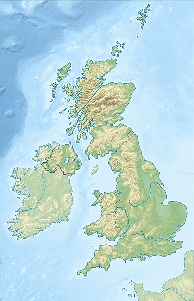
Deutsch: Positionskarte des Vereinigten Königreichs
Quadratische Plattkarte, N-S-Streckung 170 %. Geographische Begrenzung der Karte:
English: Location map of the United Kingdom
Equirectangular projection, N/S stretching 170 %. Geographic limits of the map:
|
| Дата | |
| Булак |
own work, using SRTM Data, |
| Автор | Alexrk2 |
| Башка нускалар |
|


|
This map has been made or improved in the German Kartenwerkstatt (Map Lab). You can propose maps to improve as well.
|
ПРИВЕТ ВСЕМ
Лицензиялоо
I, the copyright holder of this work, hereby publish it under the following licenses:

|
Permission is granted to copy, distribute and/or modify this document under the terms of the GNU Free Documentation License, Version 1.2 or any later version published by the Free Software Foundation; with no Invariant Sections, no Front-Cover Texts, and no Back-Cover Texts. A copy of the license is included in the section entitled GNU Free Documentation License. |
This file is licensed under the Creative Commons Attribution-Share Alike 3.0 Unported license.
- Сиз буларга эркинсиз:
- бөлүшүү – чыгарманы көчүрүү, жайылтуу жана өткөрүп берүү
- ремикс кылуу – чыгарманы ылайыкташтыруу
- Төмөнкү шарттарда:
- атрибуция – Сиз тийиштүү насыя берип, лицензияга шилтеме калтырып жана өзгөртүүлөр болсо көрсөтүшүңүз керек. Сиз муну кандайдыр бир акылга сыярлык жол менен жасай аласыз, бирок лицензиар сизди же сиздин колдонууңузду жактырган кандайдыр бир жол менен эмес.
- Бирдей шарттар боюнча бөлүшүү – If you remix, transform, or build upon the material, you must distribute your contributions under the same or compatible license as the original.
Каалаган лицензияны тандай аласыз.
Файлдын тарыхы
Файлдын мурдагы нускасын көрүү үчүн тийиштүү убакыт/датаны басыңыз
| Убакыт/дата | Миниатюра | Өлчөм | Колдонуучу | Түшүндүрмө | |
|---|---|---|---|---|---|
| учурдагы | 18:13, 17 июнь 2012 | | 1 348 × 2 083 (831 KB) | Alexrk2 | inland water |
| 18:12, 17 июнь 2012 |  | 1 354 × 2 090 (829 KB) | Alexrk2 | == {{int:filedesc}} == {{Information |Description= {{de|Positionskarte des Vereinigten Königreichs}} Quadratische Plattkarte, N-S-Streckung 170 %. Geographische Begrenzung der Karte: * N: 61.0° N * S: 49.0° N * W: 11.... |
Шилтемелер
Бул файл төмөнкү баракта колдонулат:
Файлдын глобалдык колдонулушу
Бул файл төмөнкү викилерде колдонулат:
- ab.wikipedia.org сайтындагы колдонулушу
- ar.wikipedia.org сайтындагы колдонулушу
- arz.wikipedia.org сайтындагы колдонулушу
- ast.wikipedia.org сайтындагы колдонулушу
- azb.wikipedia.org сайтындагы колдонулушу
- az.wikipedia.org сайтындагы колдонулушу
- Şablon:Yer xəritəsi Böyük Britaniya
- İrland dənizi
- Ben Nevis
- Pa-de-Kale boğazı
- Şimal boğazı
- Orkney adaları
- Lox Ness
- Arran (ada)
- Fer adası
- Qrampian dağları
- Flanan adaları
- Finqal mağarası
- Hebrid dənizi
- Kelt dənizi
- Menay boğazı
- Nort-Minç boğazı
- Pentlənd-Ferd boğazı
- Yell boğazı
- Lya-Kupe bərzəxi
- Böyük Britaniya (ada)
- Solent
- Leskov adası
- Kernqorms Milli Parkı
- Kembri dağları
- Llin yarımadası
- Ardnamerxan
- Kintayr yarımadası
- Qrinviç yarımadası
- Qauer yarımadası
- Lends End
- Trevos burnu
- Müqəddəs Yekaterina burnu
- Lizard burnu
- Ayona
Бул файлдын глобалдык колдонулушун көрүү.