Файл:Vandalia and the Dayton Airport.jpg
Учурда көрсөтүлүүчү өлчөм: 800 × 600 пиксел Башка уруксаттар: 320 × 240 пиксел | 640 × 480 пиксел | 1 024 × 768 пиксел | 1 280 × 960 пиксел | 2 272 × 1 704 пиксел.
Түп нуска файл (2 272 × 1 704 пиксель, файлдын өлчөмү: 1,83 MB, MIME түрү: image/jpeg)
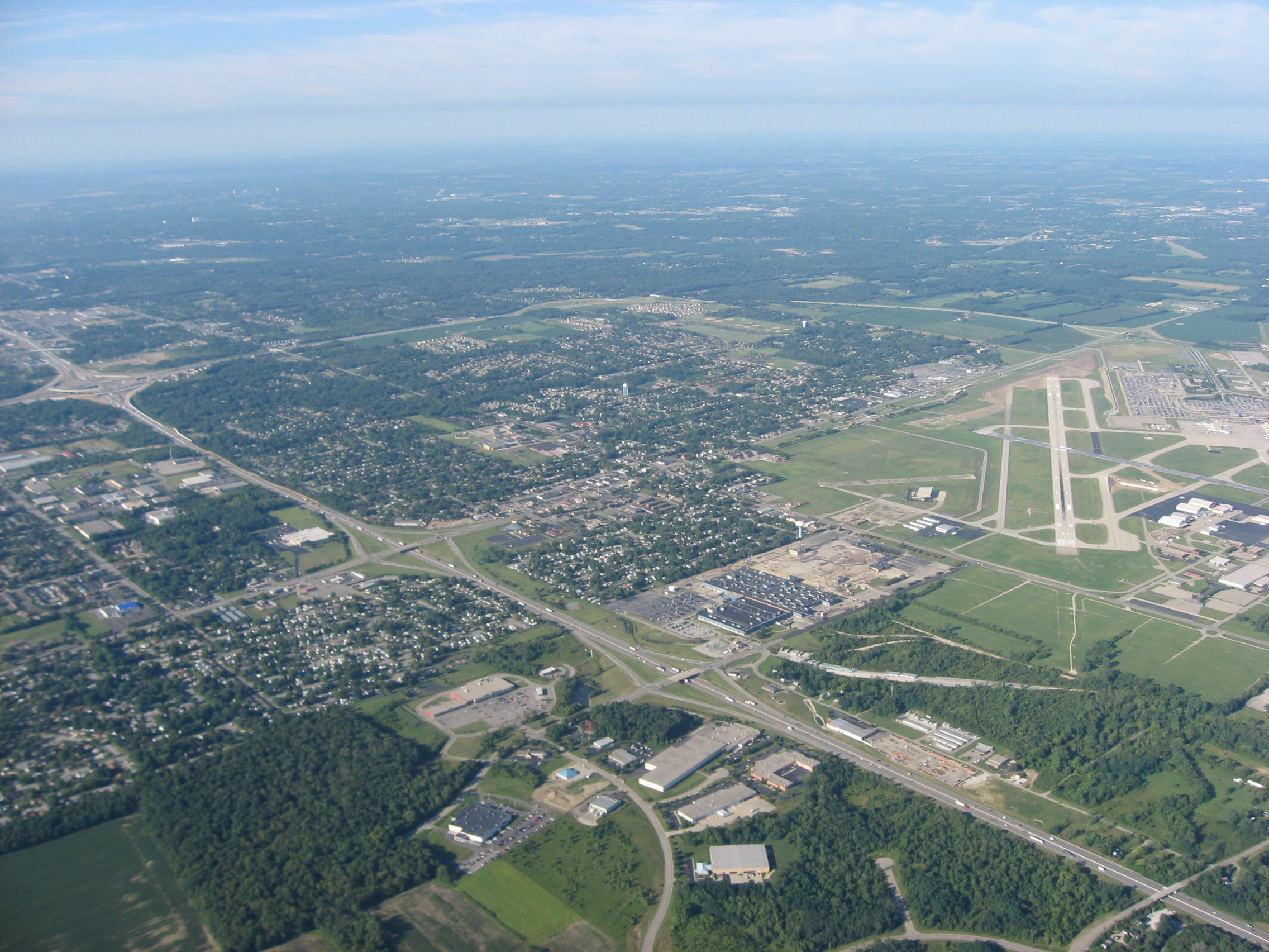
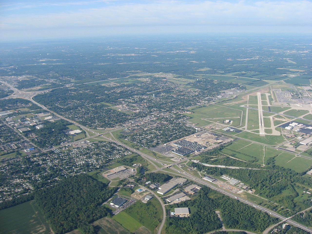
| Сыпаттама | Aerial view of Vandalia, a city in Montgomery County, Ohio, United States, with the Dayton International Airport visible to the right. Interstate 75 is visible as the major highway in the middle of the picture. Picture taken from a Diamond Eclipse light airplane at an altitude of 4,490 feet MSL and a bearing of approximately 235º. | ||
| Дата | Taken on 12 август 2008 | ||
| Булак | Өздүк чыгарма | ||
| Автор | Nyttend | ||
| Уруксат (Бул файл кайрадан колдонууда) |
|
Файлдын тарыхы
Файлдын мурдагы нускасын көрүү үчүн тийиштүү убакыт/датаны басыңыз
| Убакыт/дата | Миниатюра | Өлчөм | Колдонуучу | Түшүндүрмө | |
|---|---|---|---|---|---|
| учурдагы | 13:22, 22 сентябрь 2008 | | 2 272 × 1 704 (1,83 MB) | Nyttend | {{Information |Description=Aerial view of {{w|Vandalia, Ohio|Vandalia}}, a city in {{w|Montgomery County, Ohio|Montgomery County}}, {{w|Ohio}}, {{w|United States}}, with the {{w|Dayton International Airport}} visible to the right. {{w|Interstate 75}} is |
Шилтемелер
Бул файл төмөнкү баракта колдонулат:
Файлдын глобалдык колдонулушу
Бул файл төмөнкү викилерде колдонулат:
- ar.wikipedia.org сайтындагы колдонулушу
- arz.wikipedia.org сайтындагы колдонулушу
- azb.wikipedia.org сайтындагы колдонулушу
- ca.wikipedia.org сайтындагы колдонулушу
- ceb.wikipedia.org сайтындагы колдонулушу
- ce.wikipedia.org сайтындагы колдонулушу
- cy.wikipedia.org сайтындагы колдонулушу
- de.wikipedia.org сайтындагы колдонулушу
- en.wikipedia.org сайтындагы колдонулушу
- es.wikipedia.org сайтындагы колдонулушу
- eu.wikipedia.org сайтындагы колдонулушу
- fa.wikipedia.org сайтындагы колдонулушу
- fr.wikipedia.org сайтындагы колдонулушу
- ht.wikipedia.org сайтындагы колдонулушу
- it.wikipedia.org сайтындагы колдонулушу
- lld.wikipedia.org сайтындагы колдонулушу
- nl.wikipedia.org сайтындагы колдонулушу
- pl.wikipedia.org сайтындагы колдонулушу
- pt.wikipedia.org сайтындагы колдонулушу
- sh.wikipedia.org сайтындагы колдонулушу
- simple.wikipedia.org сайтындагы колдонулушу
- sr.wikipedia.org сайтындагы колдонулушу
- tr.wikipedia.org сайтындагы колдонулушу
- tt.wikipedia.org сайтындагы колдонулушу
- uk.wikipedia.org сайтындагы колдонулушу
- ur.wikipedia.org сайтындагы колдонулушу
- uz.wikipedia.org сайтындагы колдонулушу
- vi.wikipedia.org сайтындагы колдонулушу
- vo.wikipedia.org сайтындагы колдонулушу
- www.wikidata.org сайтындагы колдонулушу
- zh-min-nan.wikipedia.org сайтындагы колдонулушу
- zh.wikipedia.org сайтындагы колдонулушу