Файл:Westside Fairborn.jpg
Учурда көрсөтүлүүчү өлчөм: 800 × 600 пиксел Башка уруксаттар: 320 × 240 пиксел | 640 × 480 пиксел | 1 024 × 768 пиксел | 1 280 × 960 пиксел | 2 272 × 1 704 пиксел.
Түп нуска файл (2 272 × 1 704 пиксель, файлдын өлчөмү: 1,58 MB, MIME түрү: image/jpeg)
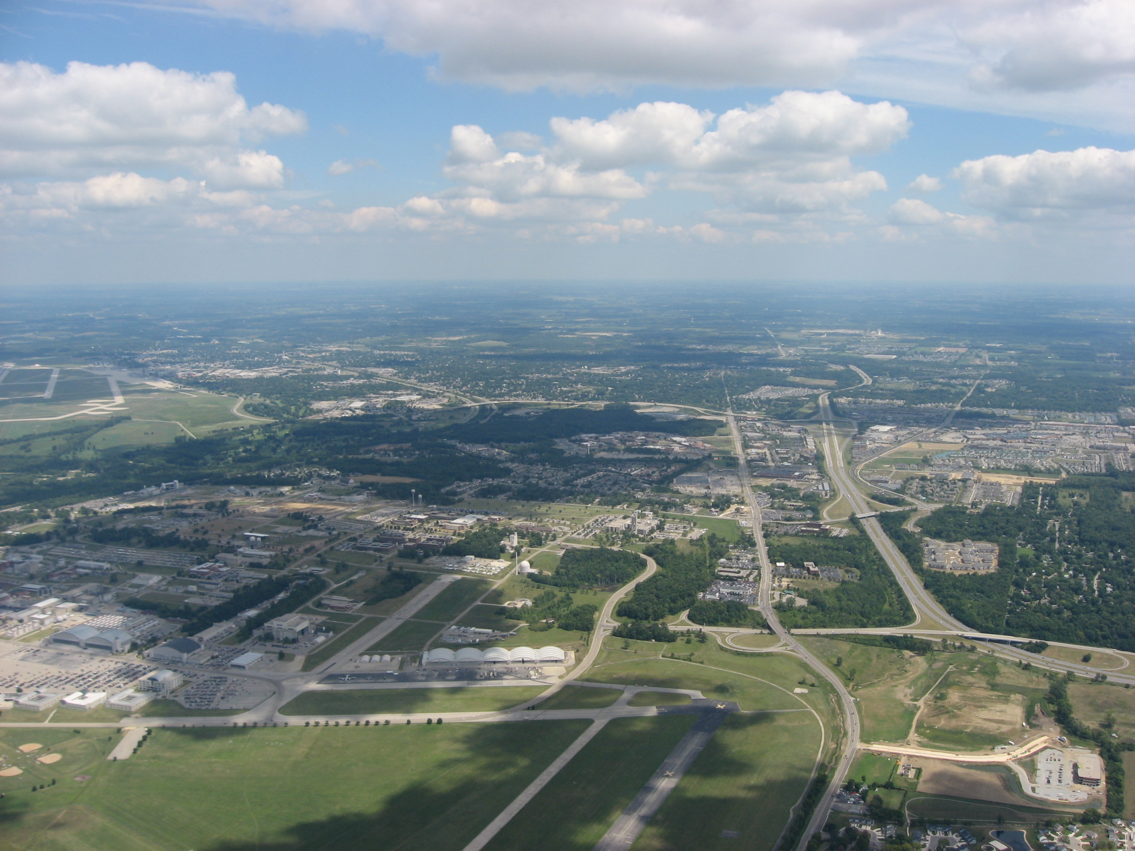
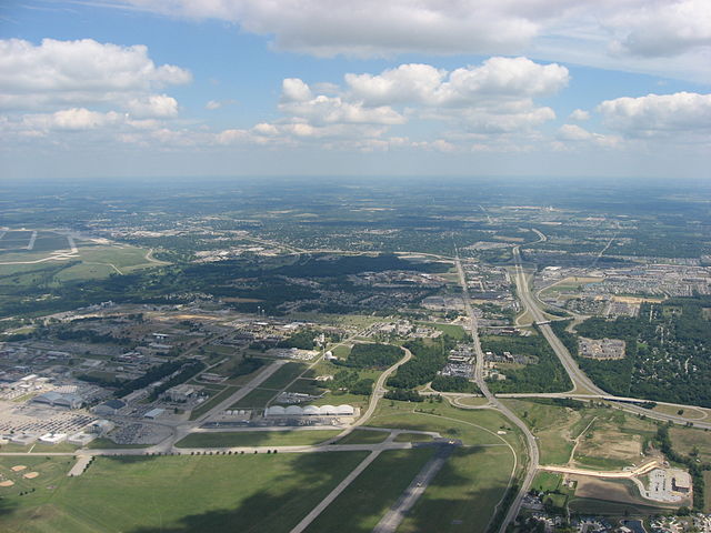
| Сыпаттама | Aerial view of Fairborn, a city in Greene County, Ohio, United States, taken from over Wright-Patterson Air Force Base. Interstate 675 is visible as the major highway on the right side. Picture taken from a Diamond Eclipse light airplane at an altitude of 3,480 feet MSL and a bearing of approximately 80º. | ||
| Дата | Taken on 12 август 2008 | ||
| Булак | Өздүк чыгарма | ||
| Автор | Nyttend | ||
| Уруксат (Бул файлды кайрадан колдонуу) |
|
Файлдын тарыхы
Файлдын мурдагы нускасын көрүү үчүн тийиштүү убакыт/датаны басыңыз
| Убакыт/дата | Миниатюра | Өлчөм | Колдонуучу | Түшүндүрмө | |
|---|---|---|---|---|---|
| учурдагы | 13:15, 19 сентябрь 2008 | | 2 272 × 1 704 (1,58 MB) | Nyttend | {{Information |Description=Aerial view of {{w|Fairborn, Ohio|Fairborn}}, a city in {{w|Greene County, Ohio|Greene County}}, {{w|Ohio}}, {{w|United States}}, taken from over {{w|Wright-Patterson Air Force Base}}. {{w|Interstate 675 (Ohio)|Interstate 675}} |
Шилтемелер
Бул файл төмөнкү баракта колдонулат:
Файлдын глобалдык колдонулушу
Бул файл төмөнкү викилерде колдонулат:
- ar.wikipedia.org сайтындагы колдонулушу
- arz.wikipedia.org сайтындагы колдонулушу
- azb.wikipedia.org сайтындагы колдонулушу
- be.wikipedia.org сайтындагы колдонулушу
- ca.wikipedia.org сайтындагы колдонулушу
- ceb.wikipedia.org сайтындагы колдонулушу
- ce.wikipedia.org сайтындагы колдонулушу
- cy.wikipedia.org сайтындагы колдонулушу
- de.wikipedia.org сайтындагы колдонулушу
- en.wikipedia.org сайтындагы колдонулушу
- es.wikipedia.org сайтындагы колдонулушу
- eu.wikipedia.org сайтындагы колдонулушу
- fa.wikipedia.org сайтындагы колдонулушу
- fr.wikipedia.org сайтындагы колдонулушу
- ht.wikipedia.org сайтындагы колдонулушу
- it.wikipedia.org сайтындагы колдонулушу
- lld.wikipedia.org сайтындагы колдонулушу
- no.wikipedia.org сайтындагы колдонулушу
- pl.wikipedia.org сайтындагы колдонулушу
- pt.wikipedia.org сайтындагы колдонулушу
- ru.wikipedia.org сайтындагы колдонулушу
- sh.wikipedia.org сайтындагы колдонулушу
- sr.wikipedia.org сайтындагы колдонулушу
- tr.wikipedia.org сайтындагы колдонулушу
- tt.wikipedia.org сайтындагы колдонулушу
- uk.wikipedia.org сайтындагы колдонулушу
- ur.wikipedia.org сайтындагы колдонулушу
- uz.wikipedia.org сайтындагы колдонулушу
- vi.wikipedia.org сайтындагы колдонулушу
- vo.wikipedia.org сайтындагы колдонулушу
- www.wikidata.org сайтындагы колдонулушу
- zh-min-nan.wikipedia.org сайтындагы колдонулушу